Did you notice the exceptionally loud and “rolling” thunder yesterday? On Saturday afternoon, the atmosphere was unstable enough for storms, and dew points had risen to the middle 60s. The air had a muggy feel to it as a line of storms approached from the west. Ahead of this line winds were out of the SSW. This brought a bit of a marine layer into Western and Central CT – just enough to cool things at the surface but not enough to kill the storms. In Eastern CT, the marine layer was so strong it inhibited the storms, which is common this time of year.

Note the dew points in the low to middle 60s with winds shifting out of the SSW ahead of the storm
With a shallow marine layer, we had what is called an inversion meaning the surface is colder than a few thousand feet overhead. On top of that war, layer, we have very cold air aloft helping to create instability, as well as a strong cold front triggering storms. In this setup, thunderstorm sounds can be amplified as the sound waves get trapped near the surface and echo. With the storms strong enough to produce many CTG (cloud to ground) strikes, an echoing effect within this layer generated the constant “rolling thunder noise.” Again, this is a more common phenomenon in the winter and spring, when water temperatures are colder.

Informative graphic demonstrating the effect from the cooler air at the surface.
The other thing that was noted within these storms was the “greenish” hue with the storms as they passed over. Dr Mel used to say “if the sky gets green it is going to get mean.” When sunlight passes through the dense, moisture-laden clouds, the shorter wavelengths (blue and green) are scattered more effectively. The greenish tint can be particularly noticeable when storms are strong, as the clouds are thicker and contain more water and hail. The hail will add an “extra green” element from the ice concentration.

Radar grab of the storm near peak intensity. This did produce wind damage in New Fairfield, as well as widespread small hail throughout Western CT
Interestingly, the presence of hail also generally comes along with a “lightning”-rich” storm, which likely contributed to the loud and constant thunder as well. This was, in many ways, a great setup for roaring thunder! You can see the greenish hues a bit below in this capture from Tom Dardis – great shot from Danbury looking north to Candlewood Lake.
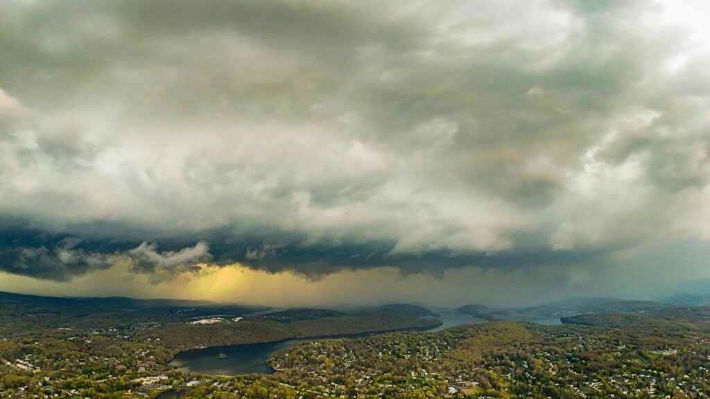
Credit Tom Dardis


