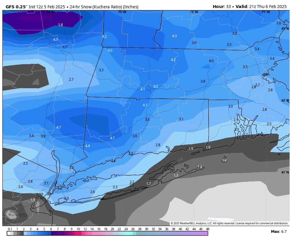
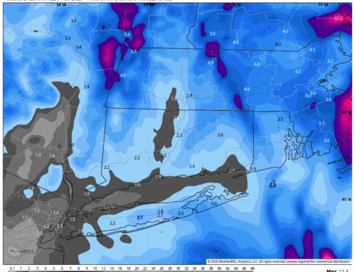
A WINTER WEATHER ADVISORY CONTINUES FOR THE ENTIRE REGION FROM 4AM to 1PM Friday. An impactful weather system is expected to arrive Thursday morning, with snow likely starting between 5AM and 8AM across the region.
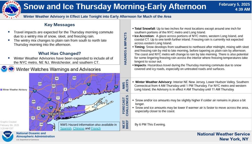
Snow accumulation is anticipated to be between 1 to 3 inches in Southern CT and 2 to 4 inches in Northern CT, followed by a transition to sleet and freezing rain in late morning to early afternoon, forming a layer of ice on top of the snow. Most of the precipitation will end before temperatures rise above freezing. Temperatures do rise to around 33 to 36 degrees by 3PM, with patchy areas of drizzle. Temperatures are not currently expected to dip back below freezing Thursday night, so not overly concerned with a refreeze Friday morning. Latest GFS modeled output of snow and ice attached which echoes forecast thinking.