Operational models have come into good alignment on low pressure tracking near or just inside the 40/70 benchmark by Sunday evening. This will allow for a swath of moderate to potentially heavy snow over the area.
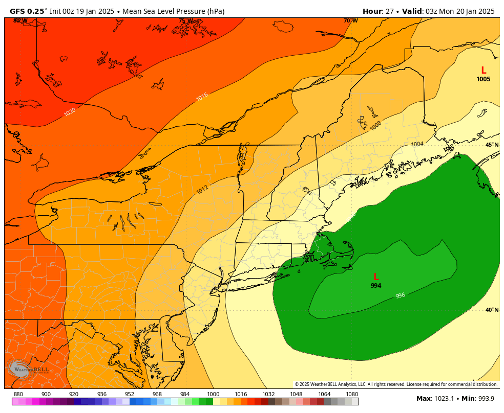
Low Pressure travels between the 40/70 benchmark and Nantucket – A good track for snow in CT
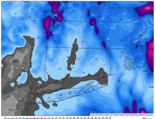
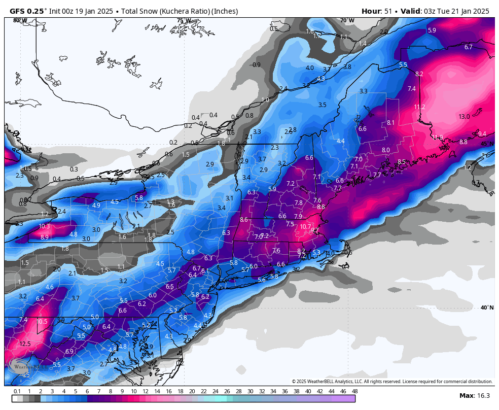
The snow will start Sunday afternoon with temperatures near or above freezing in many places. Temperatures will quickly drop, and road conditions will deteriorate by early Sunday evening. The peak of the storm will be approximately 6PM to 12AM and snow will slowly wind down after midnight. As far as accumulation, a general 4 to 8 inches is looking for more likely area wide, with expansion of the Winter Storm Warning possible to coastal CT.
Very cold weather will follow this storm, with highs struggling to get out of the low 20s on Monday and upper 10s Tuesday and Wednesday.