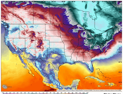
After temperatures in the 50s Tuesday and another rain event Wednesday afternoon through Wednesday night (more water is still good for the deficit) it appears we will see our coldest arctic airmass of the season Friday through Monday. This airmass is currently residing in the Yukon territory of Canada and will gradually make its way across North America all the way to Connecticut by the end of the week. This can be seen as the green and purple shading below – image is valid Sunday into Monday.
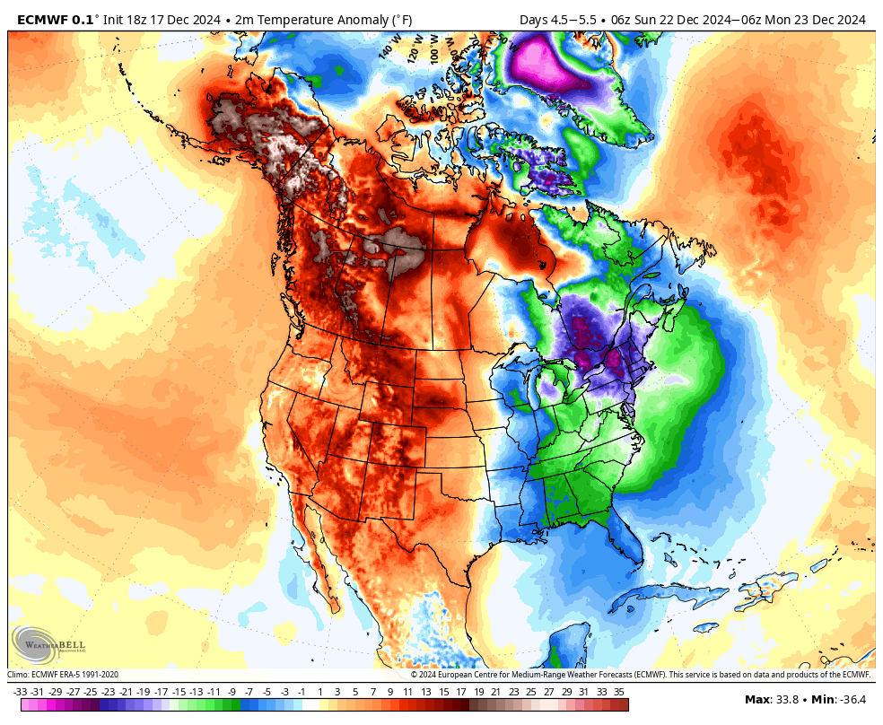
European model temperature anomalies Sunday into Monday – note the cold pool settles over the Northeast
On the leading edge of the “really cold” air, a weak clipper system will move through the region before transferring its energy to a coastal storm. As of now this looks like a relative non-event for Connecticut, but its worth watching the forecast for Friday and Friday night as light snow is certainly possible, and I have seen these types of setups trend a little snowier in the past. As it sits, snow showers Friday evening may be enough to deliver a coating to an inch through the area.
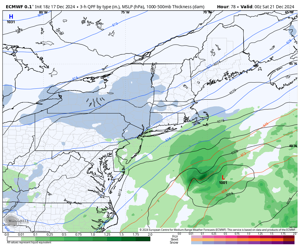
European model shows snow showers Friday evening with a C-1″ possible in spots
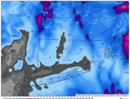
As we head deeper into the weekend, more and more cold air flows into the region. Check out the potential wind chills for Sunday morning – that is a lot of negative numbers across New England. Even without the wind, air temps will be in the single digits across the interior. On a weekend many are throwing holiday parties or have festive activities planned, make sure you bundle up!

Feels-Like or “Apparent Temperatures” Sunday morning on the European model
If you don’t like the cold, it does look like things are trending warmer from around 12/26 through 1/1. This winter already feels like it will be filled with ups and downs. Buckle up!