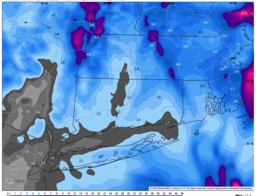
Forecast is largely the same as it has been for the last 24 to 36 hours. Some last minute trends with this storm have been a little juicier in terms of total precipitation, which has increased the snow potential a bit, especially across Litchfield County. Honestly wouldn’t be shocked to see someone report 2 or 3 inches in say Morris or Harwinton – just throwing out some random places.
Snow is working into the Hudson Valley now, and should become steadier in Western CT after midnight. Temperatures will hover around 29-33 for the evening and overnight, before slowly rising through the early morning hours. The immediate shoreline likely stays plain rain, but just inland many will see a wintery mix. Freezing rain is possible from about 3AM to 6AM, but latest models are having trouble placing who is snow, rain, and mix. It’s close!

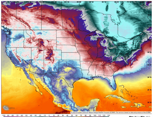
I will continue to lean on the colder side with the freezing rain and ice potential due to the strong high pressure to our east. I attached the wind vector map to help visualize the “cold drain” into CT from the NE wind. Someone is going to be glazed up good tomorrow morning, we’ll just have to see where the line(s) sets up. HRRR plot below struggling with the rain and snow line at 5AM.