This will be a very eventful weather week with multiple storm systems and lots of rain. The first system will move into the region Monday, with rain breaking out via a warm front shortly after noon. Steadier rain will taper to a few showers by Monday evening, with about 0.25 to 0.50 inches of total rainfall expected.
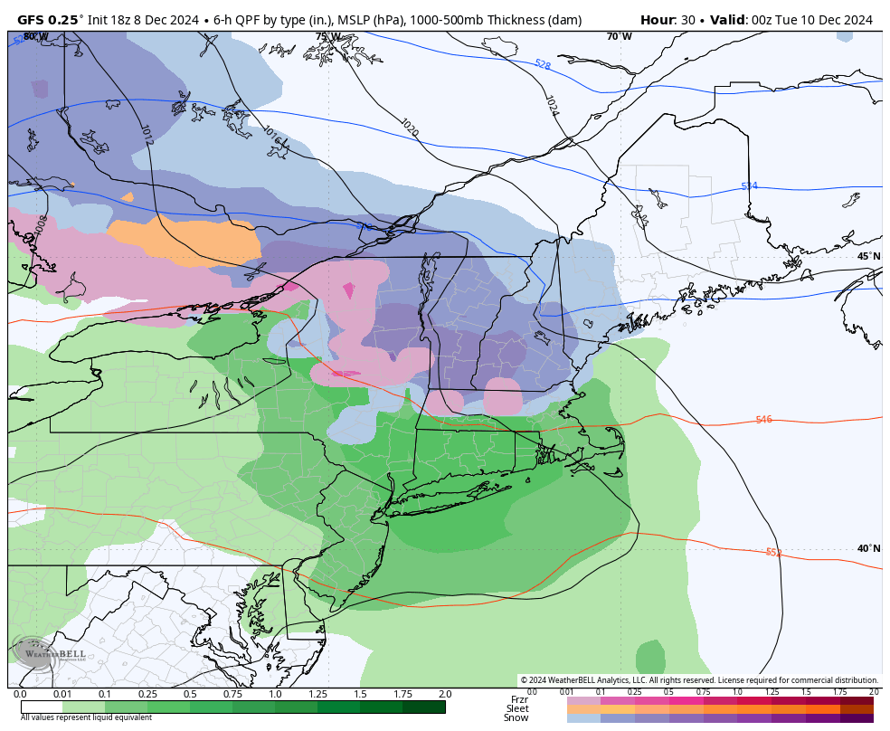
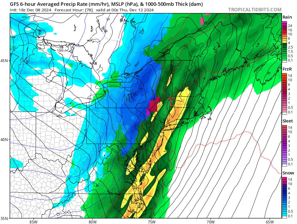
GFS with the general idea of rain Monday afternoon and evening
Tuesday will be less rainy overall, but not much brighter. Light winds, warm temperatures, and surface moisture are expected to combine for overcast skies with patchy fog and periods of drizzle. This will set the stage for a strong storm system to impact the region Wednesday, with copious rainfall and strong winds looking more likely. This storm system is in response to a deep trough over the Central US that will dive deep enough to pick up moisture from the Gulf of Mexico. This is a classic setup for an inland “cutting” system that produces heavy rainfall along the Eastern seaboard with a strong SE wind.
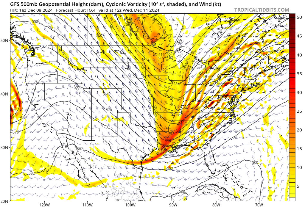
Strong trough diving deep into the Gulf of Mexico. This will force low pressure formation on the Eastern side of the Appalachians.
In recent model runs this trough has also adjusted its positioning and orientation in such a way that the eventual low track has shifted slightly west. Originally the low was supposed to track over CT, and now it looks like it may be closer to the Hudson Valley.
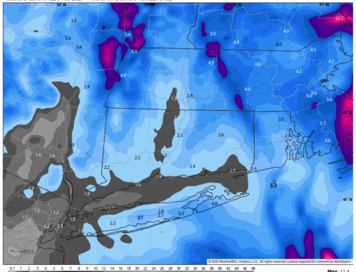
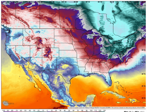
This track increases confidence in rain and wind impacts throughout the entire area. I will drop the latest European model rainfall totals and wind gusts in here. The wind gusts tend to be overdone by about 20% as not all the wind will mix to the ground, but gusts still may very well meet Advisory criteria.
-
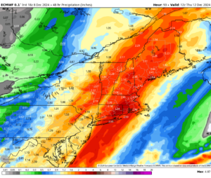
- Euro: Total Storm Rainfall
-
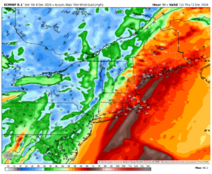
- Euro: Wind Gust Swath
Thanks for reading and have the umbrella handy this week!