Wednesday will feature our first widespread, albeit light, accumulating snow potential of the year in much of Connecticut. This is thanks to an “Alberta Clipper” system that will move down from Canada and cross over the Great Lakes. These are generally fairly moisture-starved systems that are famous for producing a quick 1-3 inches and not much more.
This storm, as currently modeled, will follow many of the same rules. The low track over Vermont is perhaps further north than is ideal for 1-3 inches of snow for all of CT, as it will allow milder air to be drawn into our area. While I do believe most places away from the beaches and New London County will be able to snow, temperatures in the low to mid 30s across the southern half of CT will likely inhibit significant road impacts given the light QPF.
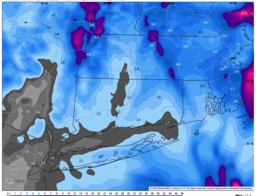
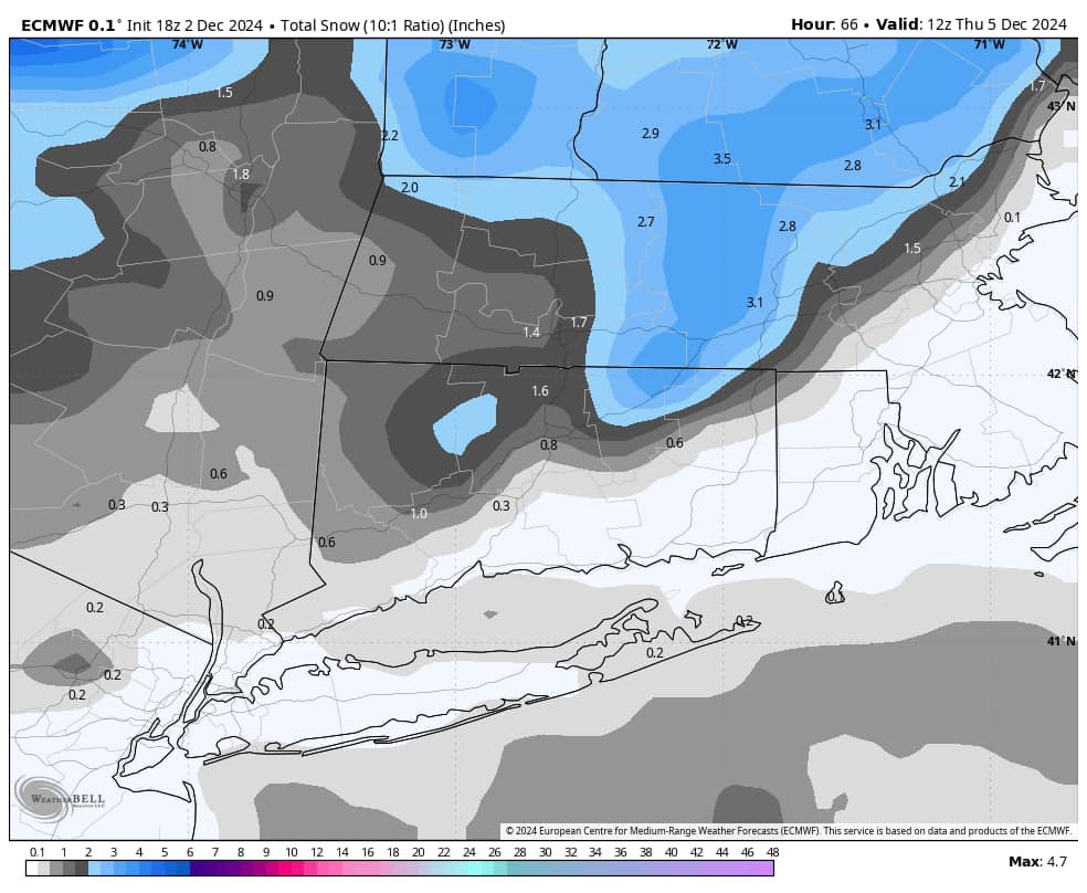
With this track, the best dynamics of this storm will also be shunted to the north and east. Right now I would favor Tolland and Windham Counties in NE CT for the highest totals up to 3 or perhaps even locally 4 inches. The latest European model run seems to show this nicely – see snow map below. Please note that warm road temperature may also inhibit sticking on pavement, especially in warmer urban areas. The first snow showers associated with this system will likely come in after 5PM Wednesday. Snow showers will then continue Wednesday night and into Thursday morning, mostly tapering off before 8AM. I’ll probably be able to refine the timing further as short range models get a better handle.
With any clipper system, we will need to keep an eye on the dynamics. There is an avenue on some other models (NAM/GFS) for a heavier burst of snow Wednesday night that would allow temperatures to fall a bit lower. If this were to verify, school delays may become more of a possibility Thursday, especially away from the shoreline. Even as modeled, delays appear possible in Northern Fairfield, Northern New Haven, Litchfield, Hartford, Tolland, and Windham Counties.
For now, I like a general C-2 for most of Western CT with 1-3 inches in Northern CT and Northeastern CT. Stay tuned!