After a warm and dry fall, the Polar Express is roaring in just in time for December, ushering in a sharp shift to winter. High temperatures are expected to struggle into the 30s for much of the next two weeks, bringing a “middle-of-winter” feel to a month that has often trended warmer in recent years.

NWS Temperature Outlook December 5th through 11th
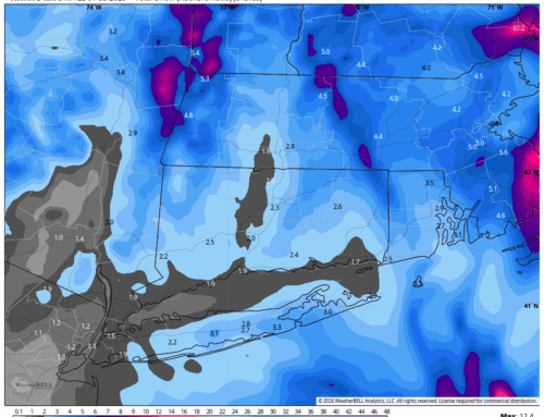
While no major storms are on the immediate horizon for heavy snowfall, the pattern is primed for smaller disturbances known as “Alberta Clippers.” These fast-moving, low-pressure systems originate in the Canadian province of Alberta and are carried southeastward along the jet stream. Clippers are typically moisture-starved, as they traverse the dry interior of Canada before reaching the Northeast. As a result, they usually produce light snowfall, with accumulations generally ranging from a coating to 2 inches, or occasionally 1-3 inches.
However, Alberta Clippers can pack a punch under the right conditions. When they tap into Atlantic or Gulf moisture, they can rapidly intensify and produce more substantial snowfall, although this scenario is less common. In recent years, the Northeast has seen fewer Alberta Clipper systems due to a prevalence of milder and more zonal (west-to-east) jet stream patterns. This winter’s early shift toward “troughing,” or a more amplified jet stream configuration, is creating a favorable setup for these clippers to reappear.
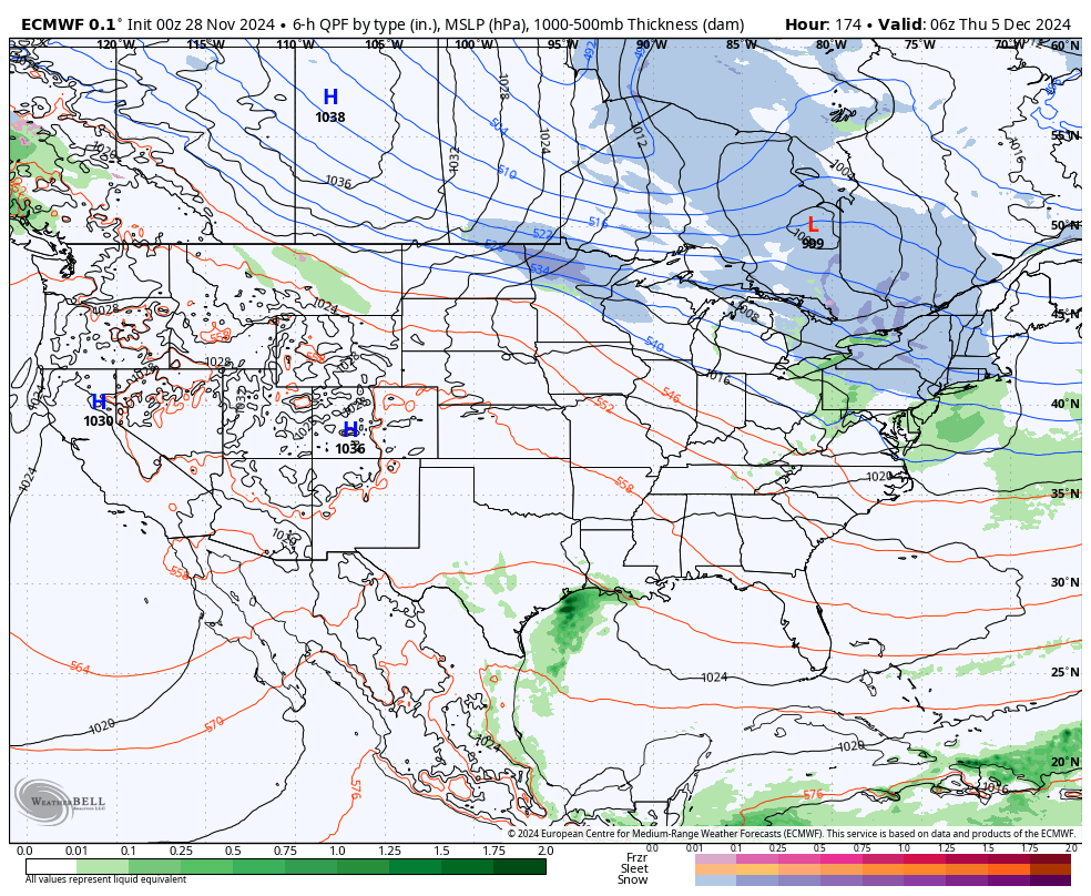
Example of a clipper system on the European model – valid early 12/5
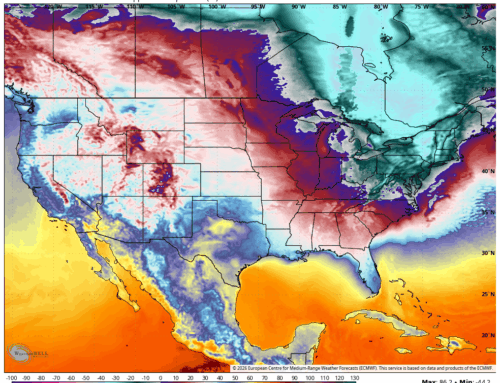
The overall pattern of a persistent trough across the eastern United States is not just bringing colder air but also enhancing the potential for additional light snow events through at least the first half of December. And while the immediate outlook favors smaller systems, it’s worth noting that a pattern like this can also pave the way for larger snowstorms. A robust trough combined with energy from the south or coastal development could easily yield a more significant event.

Pattern through the end of December – Note the Eastern Trough
As for the prospects of a white Christmas? It’s still too early to make a definitive call, but the colder-than-average pattern and active jet stream are trends we haven’t seen leading into the holidays in quite some time. For now, it’s safe to say the odds are more favorable than they’ve been in recent years, offering a glimmer of hope for a festive, snowy holiday season.