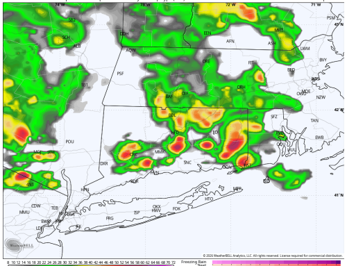
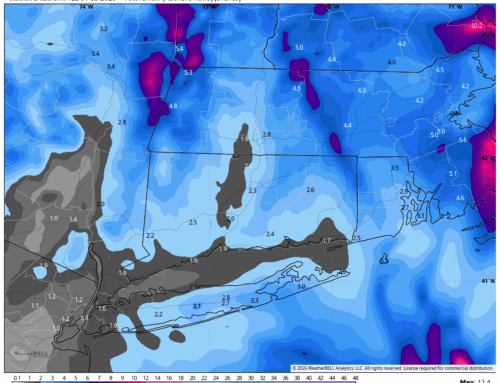
Our storm system is on track for Tuesday evening. Rain should begin between 4PM and 6PM in the Hudson Valley and Western CT, and 6PM to 8PM in Central CT and Eastern CT/RI. Still expecting a mostly rain event for the forecast area, with some mixing at the onset possible in the typical cooler climate zones of the Litchfield Hills. Even in the highest terrain, would expect minimal winter impacts, as temperatures rise Tuesday night, and any slushy accumulation is washed away. Rain will continue heavy at times Tuesday night into Wednesday morning throughout the region. Taking a blend of guidance, would expect 1.5 to 2.5 inches of rain through the region, accompanied by wind gusts 25 to 35 mph inland, and 30 to 40 mph at the coast. Do want to note that hi-res modeling has hinted at some slightly stronger gusts at the end of the storm Wednesday morning, so watching this closely. Rain ends by midday Wednesday as we begin to dry out in the afternoon. Given the slight uptick in wind and rain guidance, decided to mention the possibility of minor poor drainage flooding and isolated wind damage in the forecast. Keep it here at ctweather.com for the latest. We will update the wind and rain forecast for CT with fresh data in the morning. For now, here is an idea of the rain and wind totals via the 3K NAM hi-res model. This tracks well with forecast thinking.
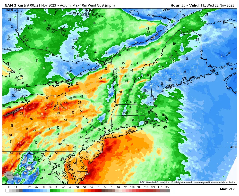
00Z NAM Max Gust (mph)
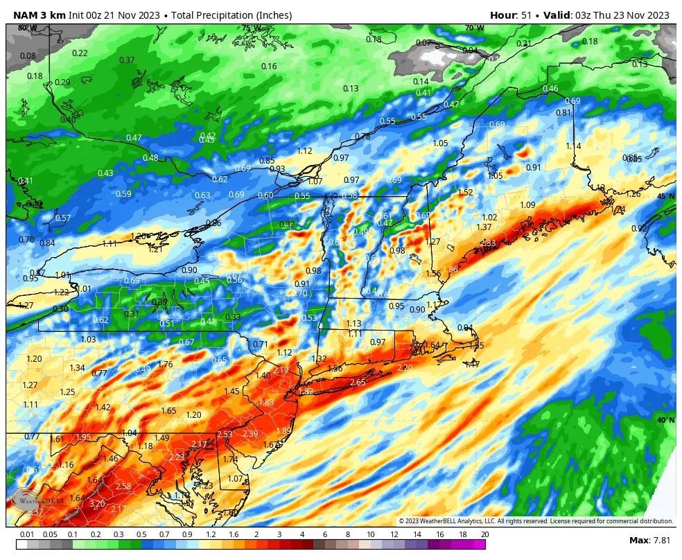
00Z NAM Total Precip (inches)

