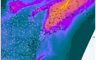
Air Quality Alert Issued for All of Connecticut on Wednesday
The Connecticut Department of Energy and Environmental Protection has issued an Air Quality Alert for several counties—including Fairfield, New Haven, Middlesex, and Northern New London—in effect from 11 AM to 11 PM on Wednesday. This alert is due to expected elevated levels of ground-level ozone, a pollutant that can pose health risks, especially during [...]
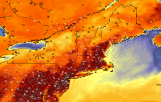
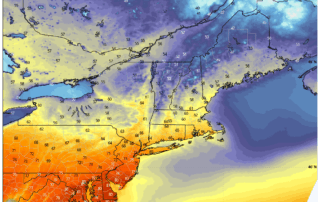
Temperatures Rise This Week Bringing a Summer Feel to CT
A strong area of high pressure in the upper atmosphere is moving over the eastern U.S. this week, bringing warm weather to Connecticut and the first chance at 90 degree temperatures this season. Winds will be light, mostly from the south at 10 mph or less. Skies will be [...]
Unsettled Weather Friday and Saturday – But is it a Washout?
It will be an interesting stretch of weather Friday and Saturday as another dynamic storm system approaches the area. Ahead of the system, a piece of energy will stretch over CT during the day on Friday. This will likely be enough to kick off some scattered shower activity Friday [...]
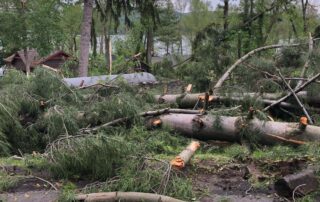
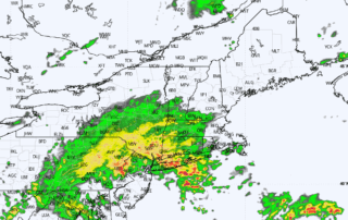
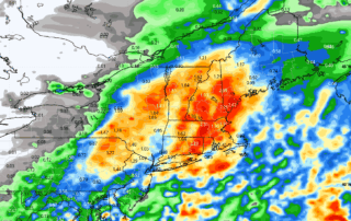
7 YEARS AGO: Storms Leave a Path of Destruction
7 YEARS AGO the worst severe weather outbreak of this generation roared through Connecticut. This remains a benchmark storm for the area, with damage still notable along the hardest hit areas all these years later. The radar frame below captures the storm near maximum strength over the Candlewood Lake [...]
Terrific Weather for Mother’s Day: Unsettled Again Next Week
It will be 10/10 ratings in the weather department for Sunday and Monday as highs for many will be near 70 degrees under sunny skies. The winds will cooperate as well, with gusts subsiding Sunday with high pressure moving overhead. HRRR Model - High Pressure Overhead by Sunday [...]
Heavy Rain Late Thursday Into Friday: What To Expect
That's right... it's about tp to get wet again. Key Points: Heavy Rainfall: Expect 1-2 inches of rain from Thursday night to Friday, with some areas in Orange County possibly seeing up to 3 inches. Flooding Concerns: Urban and poor drainage areas might experience flooding during the Friday morning commute, but [...]