

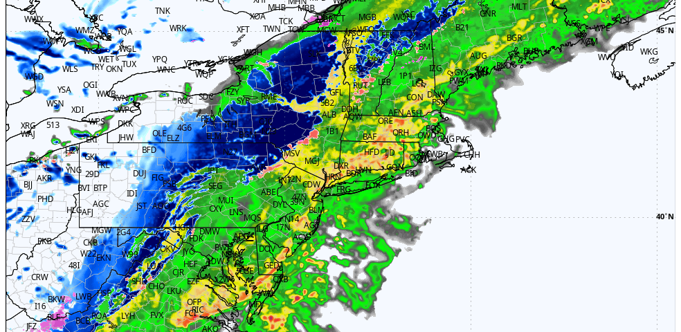
We have just briefed our clients and local Emergency Managers on the storm system impacting the region tonight through Monday.
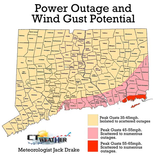
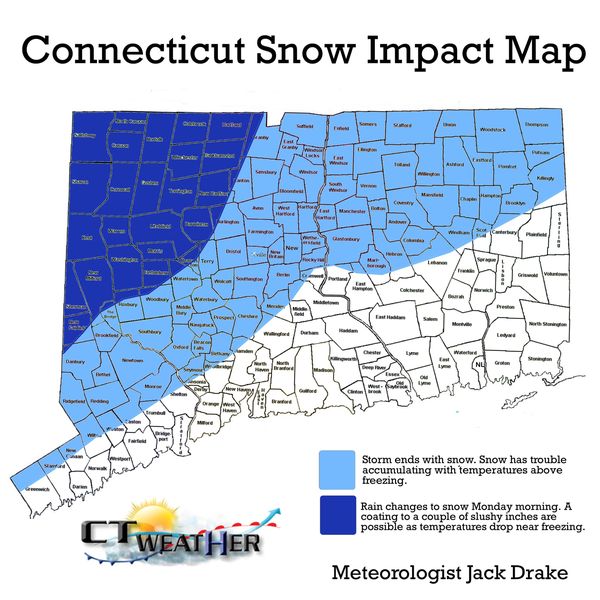
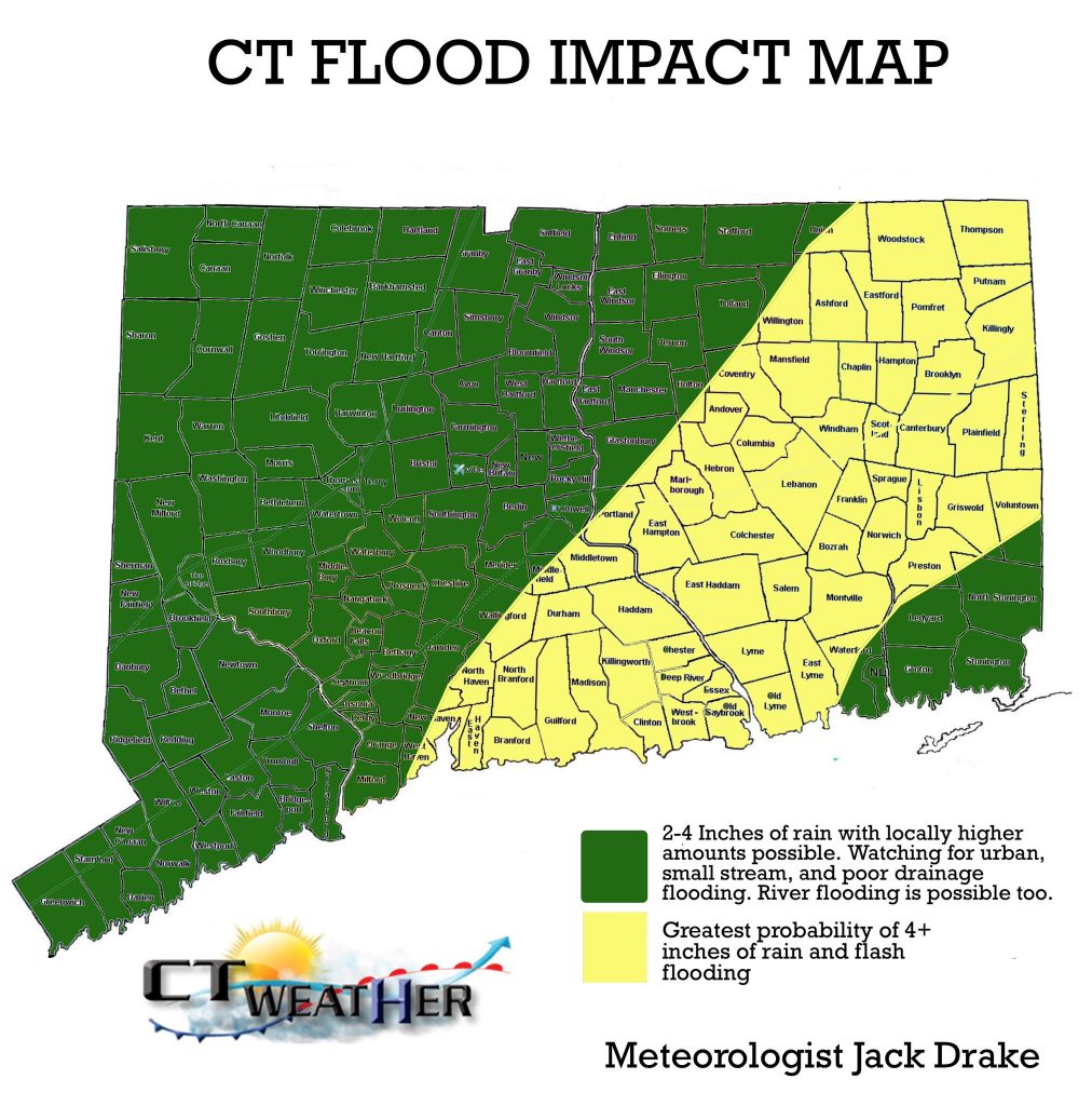
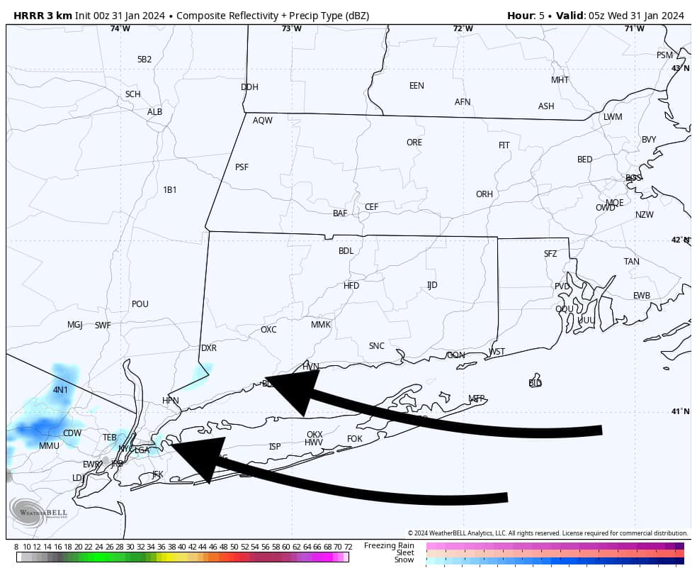
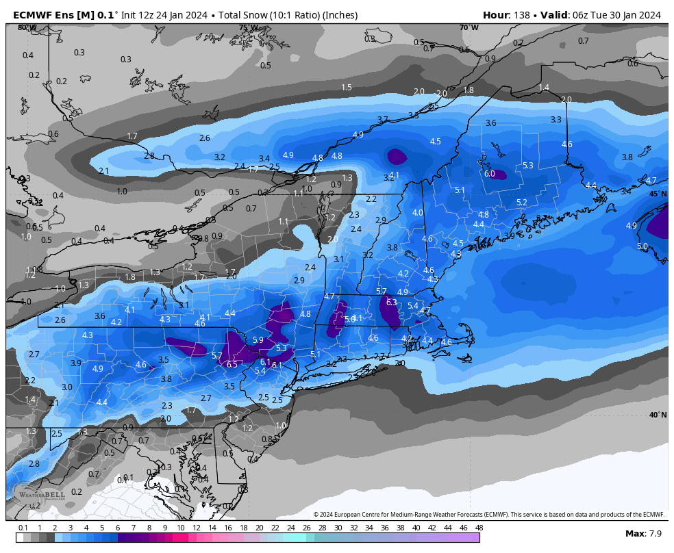
As of now, no changes to the thinking. The forecast is on track. The damaging wind risk will mostly relegated to Eastern CT, with flooding being the largest threat statewide. Expect an average of 2.0 to 4.0 inches of rain, with higher amounts possible. The absolute maximum of rain, and the largest flash flood threat, looks to be over Central and Eastern CT close to the track of the low pressure center. Some of the interior areas of Western and Northwestern CT will flip to snow tomorrow morning, but accumulations are generally not a concern outside of the highest elevations of Litchfield County.
Below is a summary of the current threat maps. We will be looking to the public in helping to assist in verifying reports moving forward. Thanks for following along!
-Meteorologist Jack Drake